Doubtful Sound History
Hours, prices and access verified by the Doubtful Sound Tours team — last checked 2026-09-26.
The history of Doubtful Sound / Patea is short on people and long on names:
a Māori name, an explorer's doubt, and a road built for a power station. The day trips
among the Doubtful Sound New Zealand tours cross that history on the way in, from the station at West
Arm to the pass named after a surveyor.
Patea, the place of silence
Early Māori named the fiord Patea, which Visit Fiordland translates as place of silence.
You will hear why when your boat stops in one of the arms. There is no settlement on the fiord,
then or now.
The fiord lies inside Te Wāhipounamu, the South West New Zealand World Heritage Area, which
takes in Fiordland National Park. The park was established in 1952 and became World Heritage in
1986.
Cook's 'Doubtful Harbour', 1770
Captain Cook sailed past the entrance in 1770. From the sea it was only just visible. Cook
judged it doubtful that the ship could sail back out against the prevailing westerly, so it
went on the chart as Doubtful Harbour, and the ship sailed on.
Cook never went in. If your cruise runs out to the mouth of the fiord, you can see what the
crew saw: a narrow gap in a steep coast, and the wind blowing straight into it.
Whalers, sealers and a new name
Many years later, Visit Fiordland says, whalers and sealers renamed it Doubtful Sound. The name stuck,
though it is a fiord, not a sound. Kekeno, the fur seals, still rest on the rocks towards
the open sea.
Cook at Dusky Sound, 1773
Cook came back to Fiordland three years later. In 1773 the expedition spent five weeks in Dusky Sound,
further south, DOC says. It remains without a road; the longer helicopter flight from Te Anau
lands above it and above Doubtful Sound.
Surveyors, a lodge and the pass
In 1888 a University of Otago professor, Mainwaring-Brown, died exploring west of Lake
Manapouri. R. Murrell, searching for the professor, became the first European to climb to the pass that year. In 1897 the
surveyor E. H. Wilmot mapped the area, and Wilmot Pass carries the surveyor's name.
By 1921 a tourist lodge stood at Deep Cove, with walking trips from Manapouri over the old
track. So the day you take now, lake then pass then fiord, has been sold to visitors for a
century.
West Arm and the power station
The Manapouri Power Station sits at West Arm, at the far end of the lake. Work began in 1964
and it was commissioned in 1971. Its machine hall was cut from granite 200 m below the level
of the lake.
The water leaves through a tailrace tunnel about 10 km long to Deep Cove. A second tunnel was
finished in 2002. There are no tours of the station, but on your trip you may have time at the
information centre at West Arm.
The Save Manapouri Campaign
The first plan was to raise Lake Manapouri to feed the station. The protest against it
became the Save Manapouri Campaign. Its 1970 petition gathered 264,907 signatures, nearly one
in ten New Zealanders.
The lake was not raised. Guardians of Lakes Manapouri, Monowai and Te Anau were appointed to
watch over the levels, with members from the campaign. You cross the lake they saved on every
trip.
The road over Wilmot Pass
Until the 1960s the pass was reached only from the sea or on foot. The gravel road was built
from 1963 to 1965 to carry loads of up to 97 tonnes from ships at Deep Cove to the station. It
remains the only road on the mainland that connects to no other road.
That is why your coach waits at West Arm. The buses are stationed at the lake end of the
road, and the boat brings you to them.
A timeline
| Year | What happened |
|---|
| Before 1770 | Māori know the fiord as Patea, the place of silence |
| 1770 | Captain Cook names it Doubtful Harbour and sails on |
| 1773 | Cook spends five weeks in Dusky Sound, to the south |
| Later years | Whalers and sealers rename it Doubtful Sound |
| 1888 | A professor dies exploring west of the lake; a searcher climbs the pass |
| 1897 | E. H. Wilmot surveys the area; the pass takes the surveyor's name |
| 1921 | A tourist lodge opens at Deep Cove, with walking trips from Manapouri |
| 1952 | Fiordland National Park is established |
| 1963-1965 | The road over the pass is built for the power station |
| 1964 | Work starts on the power station |
| 1970 | The Save Manapouri petition gathers 264,907 signatures |
| 1971 | The power station is commissioned |
| 1986 | The park becomes World Heritage |
| 2002 | A second tailrace tunnel to Deep Cove is completed |
Ready to cross the lake and the pass?
Every day trip crosses Lake Manapouri and the pass to the fiord: compare where each one starts.
Questions about the history
Why is it called Doubtful Sound?
Captain Cook sailed past in 1770, doubted the ship could sail back out against the westerly, and named it Doubtful Harbour. Whalers and sealers renamed it Doubtful Sound later. Its Māori name, Patea, means place of silence.
What does Patea mean?
Patea is the early Māori name for the fiord, and Visit Fiordland translates it as place of silence. It is written together with the English name, Doubtful Sound / Patea.
Why is there a power station at West Arm?
Lake Manapouri sits high above the sea, and its water drops through the station to Deep Cove. The station was built from 1964 and commissioned in 1971.
What was the Save Manapouri Campaign?
A protest against raising Lake Manapouri for the power scheme. Its 1970 petition gathered 264,907 signatures, and the lake was not raised.
Why is there a road over Wilmot Pass?
It was built from 1963 to 1965 to carry the power station's machinery from ships at Deep Cove. It connects to no other road.
Where these facts come from
Patea, Cook's naming and the whalers are Visit Fiordland's; Dusky Sound and the park dates
are the Department of Conservation's, checked 26 September 2026. The station, the tunnels, the petition, the
pass and the road are from the Wikipedia articles cited below, which draw on Meridian,
Heritage New Zealand and New Zealand history sources.
Trips that cross the pass the power scheme built
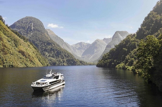
Seven hours from the jetty in Manapouri: the lake by boat, the pass by coach and about 2 hours on the fiord with nature guides. You drive yourself to the start.
From $207 per person
Check Availability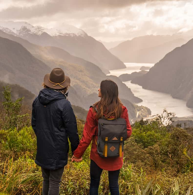
Eight and a half hours from Lakefront Drive in Te Anau: the coach to Manapouri, the lake, the pass and a 3-hour cruise. Food on sale on board, card only.
From $216 per person
Check Availability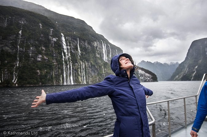
Twelve hours from 88 Beach Street in Queenstown by coach, lake boat and the pass, with a cruise of about 2 hours 45 minutes on the fiord.
From $277 per person
Check Availability