Hours, prices and access verified by the Doubtful Sound Tours team — last checked 2026-09-26.
Doubtful Sound sits at the end of a route, not an address: a lake, a pass and a
cove, reached from three towns and an airport. If you are comparing
Doubtful Sound New Zealand tours, this map shows where each one starts and how the pieces fit
together.
The route from the towns to the sea
QueenstownOutside the park. The coach days run along Lake Wakatipu to Manapouri, about 2.5 hours each way.
Te AnauFiordland's largest town, 21 km from Manapouri. The Te Anau coach leaves from Lakefront Drive.
Te Anau AirportOn the road to Manapouri, at 42 Aviation Drive. The helicopters leave from here.
Pearl Harbour, ManapouriWhere every boat trip checks in, at 64 Waiau Street.
West ArmThe far end of Lake Manapouri, and the power station.
Wilmot Pass671 m, about 45 minutes of gravel road by coach.
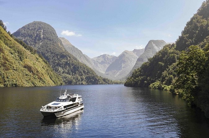
Deep CoveThe head of the fiord, where the cruise boat waits.
The Tasman Sea40 km from the head of the fiord, past its three arms.
That is the whole route, and every day trip does it there and back. From Te Anau you drive
21 km to Pearl Harbour. The boat crosses Lake Manapouri to West Arm, the coach climbs Wilmot
Pass, and you board at Deep Cove.
Where each tour starts
Where you meet
Town
What starts there
64 Waiau Street, Pearl Harbour
Manapouri
The day cruise and the overnight
85 Lakefront Drive
Te Anau
The coach-and-cruise day from Te Anau
42 Aviation Drive, Te Anau Airport
Manapouri road
The helicopter flights
88 Beach Street
Queenstown
The day trip from Queenstown
Queenstown town centre
Queenstown
The 3-day trip, at 7:00 am
The Station, Shotover and Camp Streets
Queenstown
The Milford Sound day
Your booking names your own meeting point, so check it before you set off. In Manapouri
you check in 20 minutes before at Pearl Harbour. In Queenstown, arrive 15 minutes before at 88
Beach Street.
Distances and times
From
To
Distance and time
Te Anau
Manapouri
21 km, about 20 minutes
Queenstown
Manapouri
About 2.5 hours' drive
Te Anau
Supply Bay (the vehicle barge)
21 km
West Arm
Deep Cove, over the pass
About 45 minutes by road
West Arm
Deep Cove, through the tailrace
About 10 km of tunnel
Deep Cove
The Tasman Sea
40 km of fiord
Te Anau
Milford Sound
120 km, about 2 hours without stops
These are published figures only. The drive from Queenstown is Visit Fiordland's; the lake
towns, the barge and the pass road are DOC's. The fiord's length is Visit Fiordland's, and the
tunnel is the power station's own tailrace.
Know where you will start?
Manapouri, Te Anau, Queenstown or Te Anau Airport: compare the trips from each.
Te Anau is Fiordland's largest town and, DOC says, the gateway to the park. It sits on the
shore of Lake Te Anau, and most visitors sleep here the night before. Manapouri, the second
town, is 21 km south on Lake Manapouri, with Pearl Harbour at its edge.
Queenstown lies outside the park altogether. That is why its coach days run 12 to 13 hours:
about 2.5 hours of road each way before and after the same lake, pass and fiord. If you can
sleep in Te Anau or Manapouri, you give those hours back to yourself.
DOC lists airports at Te Anau, Manapouri and Milford Sound. Te Anau Airport sits between the
two lake towns, at 42 Aviation Drive, where the helicopters leave. Supply Bay, where your own
vehicle would board the barge, is also on Lake Manapouri, 21 km from Te Anau.
West Arm and the pass close up
West Arm is where the lake ends and the road begins. The Manapouri Power Station is here,
with an information centre where your trip may stop. The coaches for the pass wait at this end
of the road.
From West Arm the gravel road climbs to 671 m and drops to Deep Cove, about 45 minutes one
way. DOC notes that parking at both ends is limited, and only for permit holders.
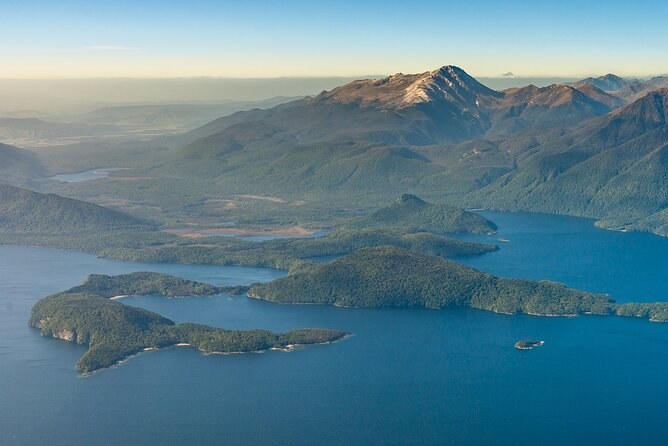
Wooded islands scattered across a wide blue lake, seen from the air
The fiord and its arms
From Deep Cove the fiord runs 40 km to the Tasman Sea. It branches into three arms, so the
boat turns into side channels rather than running straight out and back. Elizabeth Island lies
in the inner fiord, inside the Taipari Roa marine reserve.
Dusky Sound is further south, with no road. Only the longer helicopter
flight from Te Anau Airport reaches it, with a landing above each fiord.
Map of Doubtful Sound
Doubtful Sound, Fiordland, New Zealand Manapouri,
the lake, the pass and the fiord
The map loads from Google only when you press the button. Lake Manapouri is to the east of
the fiord, and Te Anau to the north-east of the lake.
Questions about the map
Where should I stay the night before?
Te Anau or Manapouri. Manapouri is 20 minutes from Te Anau, and the cruises leave from Pearl Harbour there. Queenstown works if you accept a 12 to 13 hour day.
How far is Doubtful Sound from Te Anau?
Pearl Harbour in Manapouri, where the boats leave, is 21 km from Te Anau, about 20 minutes. From there the lake crossing and the pass take you to the fiord.
How far is Doubtful Sound from Queenstown?
Visit Fiordland says to allow 2.5 hours to drive from Queenstown to Manapouri. The coach day from Queenstown runs 12 to 13 hours in all.
Where do the Te Anau trips meet?
The coach-and-cruise day leaves from Lakefront Drive in Te Anau. The helicopters leave from Te Anau Airport, on the road to Manapouri.
Where these facts come from
The distances, the barge, the pass road and the parking are the Department of
Conservation's, checked 26 September 2026; the Queenstown drive and the fiord are Visit Fiordland's. The tunnel
length is from the power station's article cited below. Every meeting point comes from the
tour's own listing.
Seven hours from the jetty in Manapouri: the lake by boat, the pass by coach and about 2 hours on the fiord with nature guides. You drive yourself to the start.